Biggenden - National Parks
Mount Walsh National Park
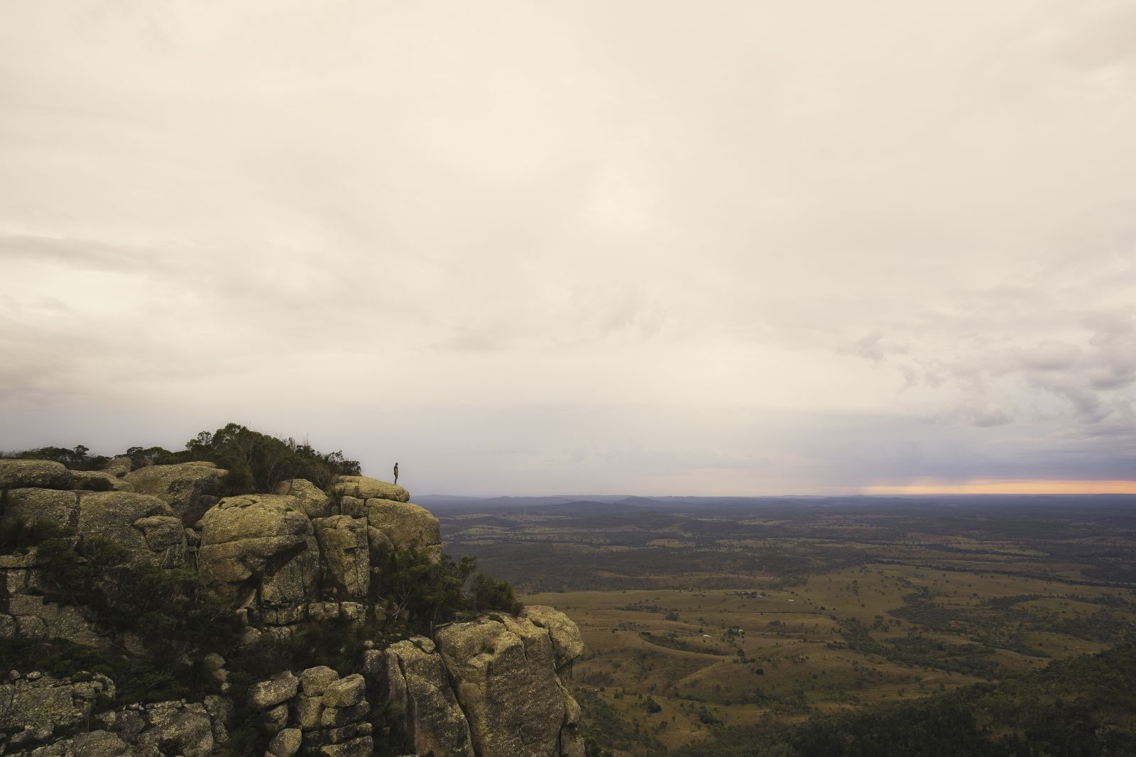
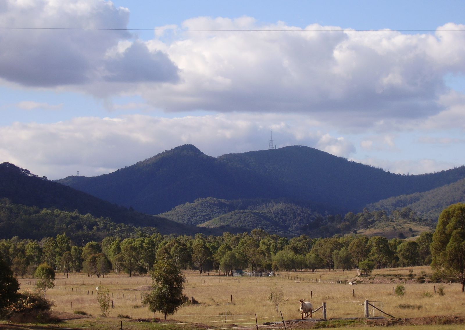
Rising to 703m above sea level, Mount Walsh National Park is a rugged park with spectacular exposed granite outcrops and cliffs. The “Bluff” area of Mount Walsh at the park’s northern end is a prominent landmark in the Biggenden area.
Most of this rugged park is suitable only for experienced, well equipped bushwalkers with sound bush skills. A 300m trail leads from the picnic area through open forest to a rocky creek gully fringed with dry rainforest. Continue 200m to the treeline for views over the surrounding countryside. Only experienced walkers should attempt the 2.5 hour hike to the summit of Mt Walsh.
Taking a walk with an accredited Bush Walking Guide is a great way for bush walkers of any experience to enjoy the National Park. Moira from Experience Altitude has over 30 years of exploring experience in Mt Walsh National Park. Moira says that "guided walks give you a chance to learn about the environment, ecosystems, walking and climbing techniques as well as local historical and Indigenous facts."
For those less adventurous but still want to get a great view of Mt Walsh, the view near the Biggenden Airstrip is easily accessible for everyone - no mountain climbing required!
Local Tip
"One of the most spectacular views of Biggenden is from the summit of Mt Walsh, and if you can climb it before dawn to watch the sunrise you will be rewarded with a sunrise you'll never forget." - Stephanie, Biggenden.
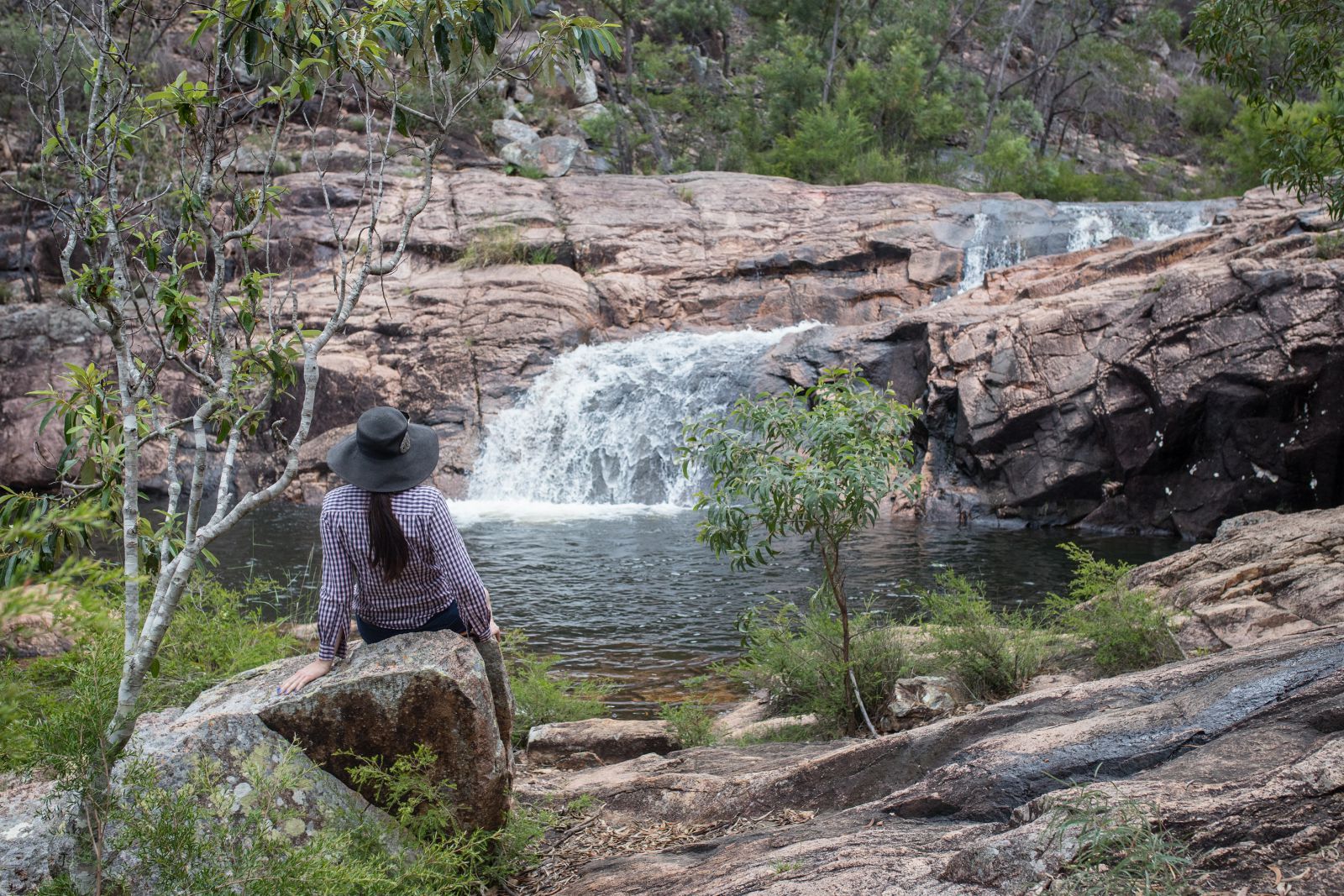
Another walking trail in the Mt Walsh National Park, popular with families is the Waterfall Creek Rockpools, known by the locals as "Utopia".
Aptly nicknamed Utopia, the trail takes you through areas of dry rainforest before arriving at a series of granite rockpools. After rain the water flows down the deep pools and into Waterfall Creek. Utopia is a peaceful place to get back to nature, have some time for quiet reflection, listen to the water flowing and chirping birds. Don't forget to bring a towel, a dip is recommended after your walk!
Facilities: Enjoy a picnic or barbecue below The Bluff. A shelter shed, toilets, barbecue and tank water are provided in the picnic ground next to the park.
Camping is permitted in the park. No facilities are provided so visitors must be totally self-sufficient. Take a fuel stove. Open fires are not permitted. Camping may be closed in periods of high fire danger. Take plenty of drinking water.
WARNING: Granite rocks are slippery when wet. Wear shoes with good grip or avoid walking during or after rain.
For walking track information, map and park alerts please check: https://parks.des.qld.gov.au/parks/mount-walsh/
Woowoonga National Park
Picnic or barbecue beside a rocky creek adjacent to the National Park. On a clear day spectacular views of Binjour Plateau, Burnett Ranges, Fraser Island and Biggenden township are possible.
Bushwalking can be enjoyed at Mt Woowoonga but it is a challenging landscape and is only recommended for the fit and experienced hiker. The trail to the lookout is an average gradient of 100 but the gradient increases to 300 to 400 on the section from the lookout to the summit. Take a compass and follow the red markers. Start your walk near the picnic area. Wear a hat and sunscreen. Take water and stay on the trail. Allow 3hours for the return trip to the summit.
For walking track information, map and park alerts please check: https://parks.des.qld.gov.au/parks/woowoonga/
Facilities: A Council picnic shelter, tank water and a wood barbecue are provided. There are no toilets.
Bush camping is prohibited. Accommodation is available in nearby Biggenden.
Coalstoun Lakes National Park
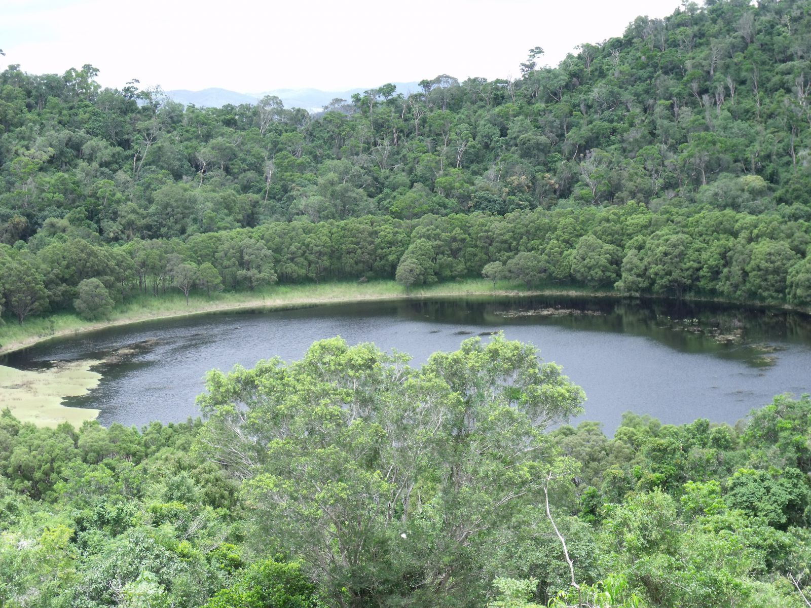
Turn off the Isis Highway 20km south of Biggenden or 4km north of Coalstoun Lakes into Crater Lakes Road. Follow the gravel track to the base of the northern crater. Rising 200m above a broad cultivated valley, Mt Le Brun contains two large craters which occasionally fill with shallow lakes.
The lakes were named after Coalstoun in Scotland by Wade Brun, manager of nearby Ban Ban Station. The crater lakes are protected in Coalstoun Lakes National Park.
This is a park for birdwatching and nature study.
Walking: Leave your car at the base of the mountain where the crater trail begins and walk up the steep outer side of the northern crater for a great view over the vine forest and crater. Continue down into the crater. Allow 30 minutes to traverse the trail which is approximately 1km return. As you head up the northern crater you will see the patch of brigalow scrub next to the park. Wear a hat, sunscreen and protective clothing to avoid being scratched by prickly shrubs in the vine thicket.
For walking track information, map and park alerts please check: https://parks.des.qld.gov.au/parks/coalstoun-lakes/
Facilities: There are no facilities in this park and camping is prohibited.
Share your adventures with us on Facebook and Instagram! #visitnorthburnett